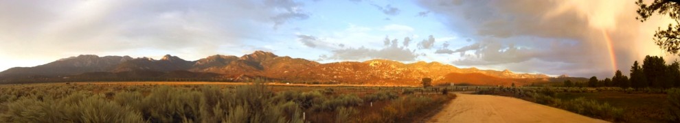
The route is finalized & sittin’ pretty at 374 miles, 31k ft of climbing.

The biggest, most notable difference between the early rough draft and the final route… no Salton Sea. The route was too long with that section, and we’ve got a fantastic diversity of terrain even without it. The new, final route features the mountains, desert, and ocean we’d set out to highlight in the first place. Oh, and we’re sitting at 80%+ dirt. Not too shabby.
We are tabulating the final cues now. In the mean time, view the route here on the leaderboard. An email with the route GPX will be landing in your inbox shortly. We’ll discuss the route in greater detail in the next post with cues attached. Get to studying!


Everyone should have the official route GPX in their inbox by now. If we can figure a way to host it here on WordPress, we’ll put it up.
The next post will be comprehensive, with full route cues, SPOT registration/rental, and whatever pertinent info we know to pass along.
This is going to be a blast!
Hi Brendan:
I have not received any info.
Colen Gereffi
Colen, glad you checked in here, the email we had from your registration bounced back. Check your inbox now.
Hi Brendan, I had an email conversation with Mary a week or so ago. Patti and I are planning to tour the route at the end of March. Could you email me the GPX file? Thanks!
gcblakleyATgmail.com
Gary Blakley
Del Norte, CO
Excellent! I’m not all that sad to not be circumnavigating the Salton Sea (getting rid of all that flat makes it much more SS-friendly in my estimation), though Palm Canyon will be missed.
Gary, you should have the track now.
Keith, the Salton Sea is a really cool area to ride. It will be back in the mix perhaps in a different form someday.
As for Palm Canyon… what you lose there you’ll instead gain in Coyote Canyon, which is a unique, special place to ride. Lesser known and a little more “wild.”
Salton Sea: Ok, I’ll be game to ride there sometime.
Coyote Canyon: I’ve only ridden that once (and probably 15 years ago) and while I don’t remember it as having nearly the great singletrack that Palm Canyon does, I agree with your assessment.
I see that there is plenty of desert in the routes. Is water a problem? How many ounces would you recommend to carry?
I found out about this race too late to register. Will there be a wait list? It’s probably too complicated to deal with but if you do create a wait list could you please put my name on it. Thank you, Dylan
I was going to do this race but I was not able to get the time off. I have talked to you several time at racers and chasers and once at your store. I was wondering if I can get the gpx file for the route so I can do it when I get time. Since I am not able to do the race.
@ Jose, yes we will have some long stretches without water, particularly on the first day between Borrego Springs and S-2. Even the next day from Oriflamme Canyon through the Lagunas will have scarce water. The cues will outline the known water sources.
@Dylan we don’t have a wait list yet, will will first need to come up with a mechanism to check riders’ commitment levels. Maybe we’ll see after people register their SPOT trackers.
@ Alex, stay tuned for a public download.
I e-mailed Scott at Topo Fusion. I purchased their basic version. It is a great program. He sent me a link on how to take the master track, simplify it into 10,000 points and then break it down into equal sections (20 total) and then load it onto your GPS for pre running and navigations. Follow this link: http://topofusion.com/tutorials/uploading-tracks.php
Thx Brendan! I’ll be watching the blog for updates and such. If it matters I have the time off and am ready to go at a moments notice. Your race looks to be an epic for sure.
Any info on the schedule for the morning of the start day and the end of the race?
@Dylan, let’s get you in. Info coming to your inbox.
@Nick, in a nutshell, we’ll meet at Hub Cyclery and be rolling out from Idyllwild, CA at 8am on the 27th, riding together at social pace to Cowbell Alley (first dirt of the route). From there you have five days to get around the rest of the route and back to a sign-in sheet in Idyllwild. We’ll have the detailed info in the second (final) Stagecoach Communique.
I too am looking forward to a public download of the route for an ITT effort.
I just found out about this race and I want to say “Thank You” to the people that put it together. Even though it is an “underground” type of event, I know there is still tons of work put forth. I’ve been mountainbike riding for many years but just recently discovered the sport of bikepacking. If, at all possible I would love the map and GPS download to so I could plan a tour ride of the same course. Who knows, maybe I can complete in 2013.
Thanks Again
I wish you all fun and good luck! One day I hope to join. In the meantime I will be watching from afar – especially the women’s race featuring the famous Jill and Mary who people like me only know from film and books. (I’m sure I’m not the only one interested to see in how that plays out!) btw – also look forward to the gpx track.