The latest 2016 Stagecoach 400 GPX file, cue sheets, route addenda, and interpretation have been sent out to all the riders participating in the smARTS Project fundraiser.
Sink your teeth in and we’ll see everybody in about a month!
-BC
The latest 2016 Stagecoach 400 GPX file, cue sheets, route addenda, and interpretation have been sent out to all the riders participating in the smARTS Project fundraiser.
Sink your teeth in and we’ll see everybody in about a month!
-BC
Posted in Maps & Cue Sheets, stagecoach info, Uncategorized
Tagged 2016 stagecoach 400, route gpx, sc400
Guidelines for self-supported riding Start with “Pedal the entire route, under your own power, using no outside assistance or prearranged support.” Add to that, the vibe of “Do nothing that not everyone else can do.” I do not believe self-supported rules have to remain static. But I do think we have agreed to an ideology of what all these “self supported events” are supposed to adhere to. We all come together for a self-supported ride with an understanding that we’re all riding under “X conditions” and go forth on the honor system. Self supported riding has significantly grown in popularity over the past few years; and I believe that’s a great thing for mountain biking, and a good for the world as it’s bringing more folks out into nature. High minded stuff, yeah. But with the boost in numbers comes some inevitable misunderstanding of the self-supported spirit, and more competition brings some more bending of the rules. Some Change Not many years ago, cell phones were strictly off-limits to self supported riding; now we have real-time, first person updates on social media. Some contend that this has made these rides less of a solo venture and more of a mainstream, fully “plugged in” event. The Trackleaders pages and SPOT tracker technology that has given these rides a spectator contingent has also been criticized by some riders for giving away too much information, and the SPOT’s SOS function have arguably given many riders a false sense of security when heading out into unfamiliar terrain.

“you and your damn cell phones”
I like to think of us Idyllwild bikepackers and our riding buddies as being from the “old guard” of self supported riding, but we’re not. We’re really the “middle guard” who started doing timed events at the very first days of cell phones being allowed; from when it was frowned upon to use them but technically “in bounds.” Spectatorship almost never happened. One of my goals in putting the Stagecoach 400 route together was- I paraphrase here- to make a badass bikepacking route. Another goal was to bring a world class bikepacking event to Southern California. I set a high standard for participation in it from the start, and never concerned myself too much with making it “accessible” to many more than the very most honed backcountry riders. Maybe 30 or so people would show up each year, I figured, hopefully some of them would come from California. The San Jacinto Enduro was a great stepping stone to get Southern Californians into longer rides, and, with enough time in the saddle new bikepackers could sharpen their teeth and eventually get into the Stagecoach 400. That was my thinking anyway. Today we have folks who’ve never been on a bikepacking trip entering the Stagecoach 400. Many folks are coming to the Stagecoach from a different angle; not indoctrinated in self-supported riding, but coming from outside conventional racing. The Stagecoach 400, lets face it, is a big riding accomplishment, as is doing a 12 hour race, the Leadville 100, or the like. And that’s cool! It’s great. Welcome to the party. I’m the old man standing on the porch, in my underwear shouting at the whippersnappers to get their act together. If I aim the garden hose at you, it’s not that I don’t like you… it’s just that I want you to be awesome. In that spirit, I’m clarifying below some common issues I’ve seen over the last few years of the Stagecoach 400. No Outside Assistance No Prearranged Support Caching some water out in the desert? Of course not. There should be no “caching” of any kind on the route. You should start with your own water, for example, and have a plan to find more along the way be it from a store, natural source, etc. The only stuff you use on the route that you didn’t start with should come from a publicly available store/source. What about using the Postal Service? You CAN use the Postal Service, or the like, but only AFTER the start of the ride. Mailing yourself a change of clothes to somewhere on the route before the ride has started is a no-no. Basically, the only reason you’ll be using the USPS is to send stuff home that broke, like your broken soul just before you throw in the towel and DNF yourself. Postal Service is damn near off limits. Want to send your sleep kit home on last day? Uncool! While technically not illegal, you’ll lose cool points and get frowns. Staying in hotels? You CAN stay in hotels, but again, DON’T make reservations until after the ride has started. Capeesh? As in, if the ride starts at 8am on Friday, don’t even pick up the phone to make a reservation until 8:01am or later. Making reservations before the ride has started is out of bounds. That would be “prearranged” get it? Meeting a friend/spouse/rider on route? Don’t do it. If you have a friend pace you up a tough canyon climb,*ahem, cough cough Oriflamme* for example, you should remove yourself from the ride and report yourself DNF. Likewise, if you feel you might need to see your SO during the ride for a conjugal visit, you probably should not enter this ride. Stay home and make sexy time. Having friends in the periphery via motorcycle, car, etc? Super uncool, out of bounds, illegal, DNF yourself. If your friends just so happened to be riding motorcycles in the desert that day, maybe you should join them. DNF yourself and enjoy a cold Smirnoff Ice. Don’t sign up if you think it’ll happen. I’m sorry to be a party pooper, but it really harshes the mellow for everyone else. Plus it’s pretty clearly taking “outside” and “prearranged” moral support. Likewise, if you’re not sure you can make it across the desert and maybe want the security of having a friend nearby to save you in case things get weird… we would rather you stayed home. We want your utter confidence that you can complete the route from start to finish. If you aren’t so sure, please keep training and consider joining us next year. Stopping by my house, which happens to be on the route? Don’t do it, unless you are stopping home to call in your DNF. Even if you broke a bike part *saddle* and you have a spare in your garage. Either go to a bike shop and have it fixed or DNF yourself. Do NOT go to your house for any reason. Calling home with my cell phone? Instagram? Facebook? Totally! It might mess with your head, but go ahead and do that as much as you’d like. Strava? Go to Leadville.
Click and ENJOY.
Thanks to Matt Palmer for doing the legwork on these. They look great.
Posted in enduro info, Maps & Cue Sheets
Registered riders should have received Communique #2 today.
There’s a live link to sign up your SPOT tracker (mandatory) and the final route cues attached.
The fish is in the water!
The route is finalized & sittin’ pretty at 374 miles, 31k ft of climbing.

The biggest, most notable difference between the early rough draft and the final route… no Salton Sea. The route was too long with that section, and we’ve got a fantastic diversity of terrain even without it. The new, final route features the mountains, desert, and ocean we’d set out to highlight in the first place. Oh, and we’re sitting at 80%+ dirt. Not too shabby.
We are tabulating the final cues now. In the mean time, view the route here on the leaderboard. An email with the route GPX will be landing in your inbox shortly. We’ll discuss the route in greater detail in the next post with cues attached. Get to studying!
Posted in enduro info, Maps & Cue Sheets
We got these written over the weekend, and will continue to turn them out as quickly as possible. Ditto for the GPS track.
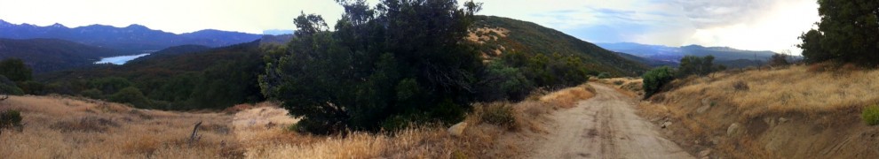
This first section takes us from the San Jacinto mountains out through grassland and into the river valleys leading to the ocean. It is nearly 75% dirt with the final 40 miles or so coming into San Diego on multi-use trail.
Download here in Excel: stagecoachcues
Download here as PDF: stagecoachcues Sheet1
Posted in Maps & Cue Sheets
Tagged Idyllwild mountain biking, Stagecoach 400, Stagecoach 400 cues
The 2011 San Jacinto Enduro was a hit!
It was the fastest year, with great weather… and smiles for miles. We’re working up some more info to share here. In the mean time, check the results page.
Also check out the sneak peek video from John & Rebecca of My Idyllwild. Check their Facebook page here.
If their teaser is any indication, it’ll be a great piece of video once it’s completed.
Loop 1 Cues. Same as last year except the change from Sunset Trail to Summit Trail at Cowbell Alley
| LOOP #1 | ||
| SPLIT | TOTAL | |
| 0 | 0 | |
| Apple Canyon road | 0.17 | 0.17 |
| LEFT ON TO HWY 74 | 0.9 | 1.07 |
| RIGHT ON TO Forest Road 6S13 | 1.62 | 2.69 |
| RIGHT turn at intersection. IMMEDIATELY AFTER CATTLEGUARD | 4.6 | 7.29 |
| RIGHT at fork over cattleguard, resume climbing | 0.8 | 8.09 |
| CORRAL,WATERTANK | 5.2 | 13.29 |
| SUMMIT begin descent. Fast stuff. | 1 | 14.29 |
| First house on left, stay on main road. | 8.4 | 22.69 |
| Cranston Ranger Station…PUBLIC WATER STOP..take HWY 74 E (uphill) | 2.1 | 24.79 |
| (NO SHOULDER, HIGHWAY DRIVERS PROCEED WITH CAUTION) | ||
| Left on to FS ROAD 5S06…Pass gate and start climbing | 2.6 | 27.39 |
| Oak stand, Halfway Springs….KEEP A CLIMBIN’ | 2.9 | 30.29 |
| Stay LEFT on main road | 1.5 | 31.79 |
| STAY STRAIGHT | 0.6 | 32.39 |
| pass through gate….STAY RIGHT on 5S06 | 0.2 | 32.59 |
| veer RIGHT | 0.6 | 33.19 |
| bear LEFT toward asphalt…follow main road to town (TOLLGATE) | 0.3 | 33.49 |
| HWY 243 turn LEFT toward IDYLLWILD | 1.9 | 35.39 |
| RIGHT on Saunders Meadow road toward Astrocamp | 0.1 | 35.49 |
| RESUPPLY OPPORTUNITY head to town, rejoin route in same place | ||
| passing PINE st. on left, Saunders Meadow road curves right. | 0.9 | 36.39 |
| LEFT on Cowbell Alley | 0.3 | 36.69 |
| pavement turns to dirt. Take IMMEDIATE singletrack on LEFT (Summit Trail) | 0.4 | 36.89 |
| Arrive at May Valley road summit/saddle. Descend 1 grade down May Valley road. | ||
| RIGHT on Log Pile Trail singletrack. (look for landing in S TURN) | 0.6 | 38.29 |
| STAY RIGHT | 0.6 | 38.89 |
| LEFT merger on to Lower South Ridge Trail. | 0.4 | 39.29 |
| RIGHT onto May Valley road | 0.3 | 39.59 |
| RIGHT onto double track. Immediate RIGHT on to Bonita Vista trail | 0.1 | 39.69 |
| Roman Highway | 1.2 | 40.89 |
| QUICK LEFT and IMMEDIATE RIGHT on to Meadow Trail | 0.2 | 41.09 |
| Left on to May Valley Road | 0.5 | 41.59 |
| RIGHT at Oak Tree.. Then LEFT on to Coffee Pot Trail | 0.3 | 41.89 |
| 200 yards… INTERSECTION stay LEFT do not go down Exfoliator | 0.1 | 41.99 |
| IF YOU ARE DESCENDING you are WRONG!! | ||
| Right on to Bonita Vista Rd | 0.7 | 42.69 |
| Stay on road past trails | 0.5 | 43.19 |
| Stay on road past trails | 0.1 | 43.29 |
| STREAM CROSSING Hurkey Creek | 0.2 | 43.49 |
| RIGHT on to SINGLETRACK 100yards past creek crossing (Missing Link Trail) | 0.1 | 43.59 |
| trail splits left or right… take your pick | 1.1 | 44.69 |
| LEFT on to 24 hour course. Rage Through the Sage. Have FUN! | 0.4 | 45.09 |
| YELLOW POST SITE #3 FIRST LOOP COMPLETE | 2 | 47.09 |
| TOTAL | 47.09 |
Loop 2 Cues
| LOOP #2 | ||
| SPLIT | TOTAL | |
| 0 | ||
| Apple Canyon road | 0.17 | 0.17 |
| LEFT on HWY 74 (view of Garner Valley) | 0.9 | 1.07 |
| Optional RESUPPLY Lake Hemet Market | 0.58 | 1.65 |
| COWPIE Spring on RIGHT immediately after 3rd bridge | 0.56 | 2.21 |
| RIGHT 6S13 then immediate LEFT through gate on to “Powerline Trail” (Close gate behind you) | 0.48 | 2.69 |
| STRAIGHT as road goes right | 1.4 | 4.09 |
| pass behind Caltrans storage yard | ||
| S-BEND in road LEFT TURN inside bend (user made singletrack descent to HWY) | 0.4 | 4.49 |
| Descend through meadow toward highway | 0.2 | 4.69 |
| Proceed through gate across HIGHWAY to Fobes Ranch rd | ||
| Climb. UP. Fobes Ranch road | ||
| CROSS cattleguard… bear RIGHT toward gate. Start Wagon Wheel doubletrack | 2.2 | 6.89 |
| RIGHT turn on to Morris Creek trail. Very rough trail | 1.73 | 8.62 |
| ENTER SMALL WASH…STAY RIGHT..TRAIL ON THE WEST SIDE OF THE WASH | 0.31 | 8.93 |
| CROSSING SMALL WASH….NOW ON THE EAST SIDE OF THE WASH | 0.17 | 9.1 |
| Indian Rock on right… arch site | 0.31 | 9.41 |
| Forest Service gate… the gnar continues | 0.24 | 9.65 |
| MERGE on to double track | 0.4 | 10.05 |
| STAY LEFT……tee onto other doubletrack | 0.32 | 10.37 |
| STAY LEFT……tee onto other doubletrack | 0.22 | 10.59 |
| Go through gate | 0.18 | 10.77 |
| RIGHT on to Morris Ranch raod | 1.5 | 12.27 |
| LEFT ONTO HWY 74 | 0.3 | 12.57 |
| RIGHT on FS 6S13 TOWARDS THOMAS MTN (PYRAMID PEAK ROAD) | 1 | 13.57 |
| LEFT on Hop Patch Spring Road | 0.3 | 13.87 |
| PAVEMENT ENDS follow signs to Thomas Mtn | 0.9 | 14.77 |
| Speed of Light Reflector on left. Anza Valley view below | 1.2 | 15.97 |
| cattleguard | 2.6 | 18.57 |
| FS Campground. Pit toilets here | 1.8 | 20.37 |
| RIGHT at pit toilets. DESCEND doubletrack | ||
| road ENDS at Tool Box Spring (unreliable water) | 0.3 | 20.67 |
| Continue between rocks at end of road. Start Ramona Trail singletrack | ||
| FOLLOW main trail. | ||
| RAMONA TRAIL SIGN…stay STRAIGHT and GIDDY UP. | 0.1 | 20.77 |
| LEFT on to POWERLINE trail. 100 yards BEFORE trailhead. DO NOT ride HIGHWAY | 3.6 | 24.37 |
| Go through gate (close behind you) proceed to HWY 74 West | 3 | 27.37 |
| Cowpie Spring, Lake Hemet Market on RIGHT. | ||
| RIGHT Apple Canyon Road | 1.62 | 28.99 |
| LEFT at Yellow Post marker | 0.9 | 29.89 |
| SIGN TIME LOG….eat, drink, and be merry! | 0.17 | 30.06 |
| TOTAL | 30.06 |
Guy Sutton was gracious enough to share this with us.
Check this link for Loop 1 info.
Besides bearing evidence of Guy’s superhuman badassery, this link can help provide you with some more course insight*, including a GPS’d route of the tricker singletrack sections in May Valley.
Use it for good, not evil.
*note: this track shows some minor detours, such as an optional jaunt into Idyllwild for refreshment. As a reminder, detours to public places are fair game, but you’ll have to ride every bit of the Enduro route to complete it. ie, go to the grocery store and rejoin the route at the same intersection you departed from.
Dig?
“Every minute I stay in this room, I get weaker, and every minute Charlie squats in the bush, he gets stronger.”
– Apocalypse Now

Reports have been coming in from Enduroheads out on course. Riding. Training. Strategizing. Timing.
Word’s come in of at least one sub 7-hour full practice loop time, and many other blazing segment times.
The big day is getting closer.


